
Aerial Photography Services In Indiana
- Aerial Photography(Residential, Commercial, Agriculture)
- Real Estate
- Agriculture / Crop checking
- Equipment Inspections
- Property Overviews
- Property Mapping
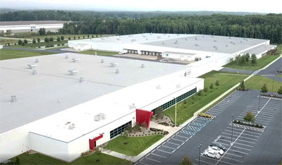
- Factory Properties or high-altitude too high for drones
First step,
Contact & Scheduling
The goal of our aerial photography team is to ensure the mission of our clients is met. Whether you want low altitude or high altitude aerial photography. We work with local pilots for high altitude photography and are capable of getting very large properties. – MLT can make it happen!
Flying and Shooting
Here’s where it all happens
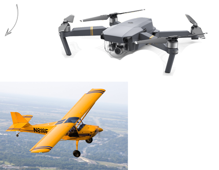
After you review and green light the project, it is time to shoot. We will work with local pilots and meet with them to brief them of the needed flight paths to ensure we get the aerial shots our clients want. For low altitude (under 300 feet), we utilize our drone to take photos. Anything that is needing a wider angle or higher altitude will require us to photograph from an airplane. All FAA regulations are followed.
We Upload your files
Once we are completed and selected on the best images from the shoot to show you, we will upload them via Google Drive for you to download and approve.
Contact Us today for more information or to schedule your aerial photography shoot anywhere in Indiana.[/one_second last]
Drone services:
Aerial Photography(Residential, Commercial, Agriculture)Real Estate VideographyAgriculture / Crop checkingEquipment InspectionsProperty Overviews